
[Editor’s note: This guest post is by Lane Davis. Lane is a former School for International Training student who spent a semester in Ecuador and did her independent study project with us. She then won a Fulbright scholarship to return to set up three research plots in our Cerro Candelaria Reserve, at 2000m, 2500m, and 3000m. By identifying every tree in each plot, she has generated data which can help us quantify and understand not only the diversity of our forests, but also the important differences in composition between our forests at different altitudes, and between the Cerro Candelaria forests and others locally and globally. This kind of data provides a much-needed step towards understanding the deeper underlying causes biodiversity – LJ]
[Traduccion a Espanol abajo]
Photos courtesy Lane Davis unless otherwise noted.
“And this?” Javier asks with anticipation as he opens the folded newspaper sheet labeled #47. I open my warped, mud-covered Rite in the Rain field notebook and look up the number. “Canopy tree, no latex or odor but the bark slash oxidized from white to brown. Do you want to see the live photos?” I ask. Javier shakes his head no and picks up a hand lens. I do the same and we each lift into the light a pressed and dried branch and examine it with our hand lenses.
Under the 30x magnification, the underside of the leaf shimmers with thousands of little scales. “What is it?” I ask him. Javier shrugs his shoulders almost jubilantly, muttering “Incredible,” and places the sample in a growing stack of unidentified plants. Later, we will scour Alwyn H. Gentry’s cinder block of a book “A Field Guide to the Families and Genera of Woody Plants of Northwest South America” and Walter Palacio’s “Árboles del Ecuador” (Trees of Ecuador) for families and genera of dicots with simple, opposite, alternate leaves; entire margins; and peltate trichomes (those shimmery scales) that could match sample #47. In this way, we will shrink the unknown stack, labeled “Desconocidos,” moving each plant we identify instead to piles of taxonomically related plants. But we will only make significant headway into the “Desconocidos” stack when we meet with another botanist, Walter Palacios. Yes, the same Walter Palacio’s I mention above who quite literally wrote the book on identifying trees in Ecuador. Javier and Walter are friends. Ecuador is a small country and its scientific community smaller, so pretty much all botanists know one another (which made it a little embarrassing when I asked for Walter’s signature on my copy of “Árboles del Ecuador,” but it was worth it).
But for now, Javier plunges back into the samples we haven’t reviewed at all yet. He grows more incredulous yet ecstatic each time he peels open one of the newspapers in which I have carefully pressed and dried tree clippings. Sometimes he takes one look and proclaims the tree’s family, “Fabaceae” or “Lauraceae,” or even the genus, “Inga” or “Ocotea,” and I record this proclamation in my Microsoft Excel database and in the corner of the newspaper. But around half the time the sample remains with only a number to identify it.


One of my samples identified to family level. This is a member of one of the largest neotropical plant families, the Melastomataceae.
This uncertainty thrills Javier, a talented botanist, biologist, and the Executive Director of Fundación EcoMinga, the conservation organization I am affiliated with for my Fulbright work and which owns the forest where my dried tree clippings once grew. He has spent an unknowable number of hours traipsing through Ecuadorian forests; if he doesn’t recognize the plant, it must be at least somewhat rare. Javier also gets excited any time my pile of pressed plants yields a species he hasn’t seen in my samples yet, regardless of whether or not he knows what it is. With the discovery of each unique species, tree diversity goes up. The diversity of my plot, the 40m x 40m section of the forest where I gathered my plant samples, goes up in an absolute sense – one definition of diversity is simply the number of species present in a given area. But the implied diversity of the forest surrounding my plot shoots up even faster. My small plot cannot possibly capture the full diversity of the cloud forest, but we can use my data to estimate it. This calculation is based on the number of singletons, or species for which we have found only one individual tree in the plot. If singletons make up a large portion of the data, then we know the data isn’t representing the forest’s diversity well and there must be many yet undiscovered species outside of my plot. (For more on these calculations, see Chao and Jost 2012 and Chao et al. 2014).
For my part, the identifications and repetitions of plant groups are just as exciting as the unknown and new species; with each familiar sample and identifiable family characteristic, my own ability to identify cloud forest trees expands and solidifies. Unlike Javier, I have spent a knowable number of hours in the Ecuadorian cloud forest – to date, about 275 (not including evening and night hours when I slept in the field). Almost all of this time I spent collecting the plants piled in front of us, or walking to one of my three plots to do so.
During data collection, I lived in the 250-person village of El Placer at the base of Cerro Candelaria, the forest reserve owned by Fundación EcoMinga where I collected the now pressed and dried tree samples. Each morning I set out at 7:00 am, often but not always accompanied by a guardabosque (a forest ranger), and hiked to one of my three plots in the reserve. When I wrote my Fulbright grant proposal to study the vulnerability of Andean cloud forest trees to climate change, I planned to do so by learning about the altitudinal distributions of different trees species using eight different 10m x 100m plots ascending the mountain slope in Candelaria. Species growing in only a narrow altitudinal band will likely have a tougher time keeping up with their ideal growing conditions – as climate change shifts those conditions upslope – than species that are adapted to the conditions in a large geographic range. It quickly became clear that I would not have enough time in the 10-month grant period to take data in such a large area, and Javier and I decided to modify our methodology to match that of the Evaluación Nacional Forestal (National Forest Evaluation) taking place in 2018, which uses square plots. That way, the Ecuadorian Ministry of the Environment could use our data in their study, too.


Views from and of El Placer
As a result, each morning I left El Placer to arrive at one of three 40m x 40m plots, located at 2000 m (6562 ft), 2500 m (8202 ft), or 3000 m above sea level (9843 ft). Beginning from 1400 m (4593 ft), my commute required 2hrs and a very steep 1969 ft elevation gain to my first plot, 3 hrs and a crushing 3609 ft gain to my second plot, or 6 hrs and a demoralizing 5250 ft gain to my third plot. Consequently, I often camped in the field when I worked at my second plot and always did at my highest plot.


Campsite in and views from my plot at 3000 meters (nearly 10,000 ft above sea level).
I hiked through the Andean cloud forest, which usually meant hiking through a forest submerged in clouds. Cloud forests exist on mountains near lowland sources of atmospheric moisture – usually the ocean but in this case the Amazon Rainforest. Prevailing weather patterns push this moisture up the slopes, where it cools and condenses into low-level clouds, mist, or rain, leading to the frequent presence of precipitation in one of these forms.


Clouds in the cloud forest.
When I first began taking data in the cloud forest, I had no idea how to identify the trees around me, and with good reason. Though I took Field Botany at Williams College and identified plants as part of my senior Biology thesis, there are only a little over 70 species of trees in the state of Massachusetts (Butler 2016). In comparison, 131 different species of trees exist in the 4,000 square meters (slightly less than 1 acre) of cloud forest I have examined. Working to identify these trees using my dried samples, photos, books, the internet, the collections at the National Herbarium (a library of preserved plant samples), and significant help from professional botanists, I have slowly learned to recognize the defining characteristics of my plots’ most common families, genera, and species. Now when I walk through the forest, morphological features of plants capture my attention, often provoking a scientific name to come to mind. Large conical stipules, ring scars, and latex scream Moraceae; interpetiolar stipules insinuate Rubiaceae; and petiolar sheaths with a sweet soapy smell proclaim their identity – Hedyosmum.

Photo: Fausto Recalde/EcoMinga.


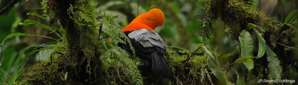
Cloud forest diversity is not confined to its trees. Far from it. For example, in the past 10 years, around 40 new species of orchid and 10 new species of frog have been discovered in EcoMinga’s reserves in one relatively small section of the Ecuadorian cloud forest. Above, a few photos of the incredible non-tree diversity of the cloud forest.
These trees and the billions of organisms that live on, under, and around them, ranging from soil microorganisms to Howler monkeys, as well as the inorganic features of the landscape like rocks and soil, make up the cloud forest ecosystem. This intricate network provides critical services to the human populations that make their home in the Andes Mountains. For example, cloud forest soil and epiphytes (plants that live on other plants and draw water and nutrients from the air rather than the soil) filter and regulate the flow of the glacial water which services millions of people in rural and urban Andean communities (Anderson et al. 2011). The extensive cloud forest root system helps hold soil in place, preventing erosion and landslides (Anderson et al. 2011). Climate change will disrupt these and other services, threatening human and ecosystem health and safety. For example, more intense rains combined with tree die-offs will increase erosion and landslides, which threaten human safety and water supply. In Quito in 2017, a landslide blocked the city’s main water channel, leaving 600,000 people without water for several days (Manetto 2017). In El Placer landslides occasionally cover pipes and cut off water; in my six months living there, this occurred once. [Editor’s note: See my previous post.]
Disruption of water supply is just one example of the myriad potential ways climate change and the resulting deterioration of the cloud forest ecosystem may affect El Placer and other similar communities nestled in Andean valleys. Better understanding the cloud forest’s fate under climate change will allow for targeted approaches to climate change preparation, for instance by creating emergency water delivery systems. Given the imminence of climate change, however, it is critical to implement strategies that decrease vulnerability to a wide range of climate change outcomes. I recently wrote a paper for Fulbright’s Regional Enhancement seminar on the how Fundación EcoMinga and El Placer’s partnership may do just that. I argued that EcoMinga bolsters El Placer’s climate resiliency by providing economic activities to the community that are less likely to be impacted by climate change than those that are otherwise available to them.
The main way EcoMinga does this is by employing community members as forest rangers in its reserves. The forest rangers build and maintain trails and cabins, assist visiting scientists and students with their research, and serve as keen eyes that often discover new species and other interesting biodiversity. My own work would have been out of reach (literally) without the help of Darwin Recalde, Jesús Recalde, Tito Recalde, Santiago Recalde, Jordy Salazar, and Andy Salazar. These men climbed 30-meter tall trees to reach leaves and flowers at the very top – those same leaves and flowers that now sit preserved in the National Herbarium in Quito and that make up the rows of my datasheets with which I will try to say something about the forest’s future.

Darwin Recalde climbing a tree to cut a sample of its leaves.
In fact, this goal – to assess the forest’s future under climate change – has morphed throughout my grant period. As with any interesting scientific study, this one has produced more questions than it will answer. Based on the calculations I mentioned earlier, though I took samples from 73 different tree species in my lowest altitude and most diverse plot, these represent less than half of the total number of species in the forest at that altitude. What other species does the forest in this area contain? What allows the most common species I found to thrive? How will climate change affect its strategy? How will the forest’s response to climate change compare with my predictions? Will adaption differ in different locations within the cloud forest? Do these responses correspond with different microclimates? How do other aspects of the tree’s environment, like soil type and slope, affect forest adaption?
Many of these questions will only be answerable with a long-term research project. I have recently learned that my work will become part of just that. Fundación EcoMinga and the Instituto Nacional de Biodiversidad (National Institute of Biodiversity, or INABIO) are beginning a long-term forest monitoring collaboration. The study will comprise a network of plots in the Ecuadorian cloud forest including my three, a few other existing plots in EcoMinga’s reserves, and several more yet to be established. Tree growth, climate, and forest composition will be monitored regularly in these areas, and the data from my 2017-2018 study will form the baseline to which future measurements from my plots will be compared. While EcoMinga and INABIO are still determining details, the research will shed light on many of the questions my study has produced. In addition to providing baseline data, there are other ways I can help move this project forward. For one, I am striving to make the R (a statistical program) code I am writing to analyze my own data easily reproducible so other researchers and students can use it for quick analysis of data from all the plots.
This is an aerial view of Lane’s Plot 1 at 2000m elevation in our Cerro Candelaria Reserve. We fly over the 40m x 40m plot in the first few seconds, and then continue down the ridge to hover above our research station. Video by Lou Jost.
This is an aerial view of Lane’s Plot 2 at 2500m elevation in our Cerro Candelaria Reserve. We break through the clouds and fly straight to the 40m x 40m plot in the first few seconds, heading upslope. Then we turn around and float slightly downslope over and past the plot. Video by Lou Jost
I can also help by recruiting more students to continue the study. So much exciting work remains to be done. In addition to expanding and monitoring my plots, ample opportunities to personalize the project exist. For instance, you (yes, you!) could explore using drone imagery to identify trees from the air, investigate the role of rodents in seed dispersal, study the timing of tree sexual reproduction (phenology), or look at the genetics of cloud forest tree diversity – and how each of these impacts the forest’s adaption to climate change. All of these are areas in which EcoMinga currently works or would like to pursue. Whatever interests you, you will find enthusiastic scientists in Ecuador to support you. And if none of this attracts you but you know of others who it might, please send this post along to them.


Example of aerial images of my plots that could be used to identify trees. Thanks to Lou Jost and his excellent drone piloting for these images!
Finally, we can all support EcoMinga, its work conserving the cloud forest, partnership with El Placer, and scientific collaboration with INABIO by donating to the Foundation through the Orchid Conservation Alliance (US), the World Land Trust (UK) and Rainforest Trust (US). (Make sure you specify that the funds are for EcoMinga.) Contact Lou Jost (loujost@gmail.com) for more information about donating.
Thank you for reading! If you are interested in continuing this work and/or in hearing more about it, please do not hesitate to contact me:
Lane Davis
lanedavis17@gmail.com
(404) 805-2234 (WhatsApp or iMessage only until I am back in the US on May 11, 2018)
The opinions and information reported here are my own and do not represent those of the Fulbright Ecuador Commission, the Fulbright U.S. Student Program, or the U.S. Department of State.
References
Anderson, E.P., Marengo, J., Villalba, R., Halloy, S., Young, B., Cordero, D., Gast, F., Jaims, E., and Ruiz, D. Consequences of Climate Change for Ecosystems and Ecosystem Services in the Tropical Andes. In Climate Change and Biodiversity in the Tropical Andes; Herzog, S.K., Martinez, R., Jørgensen, P.M., Tiessen, H., Eds.; Inter-American Institute for Global Change Research (IAI): MOtevideo, Uruguay; Scientific Committee on Problems of the Environment (SCOPE): Amstelveen, The Netherlands, 2011; pp 1-19.
Butler, B. J. 2016. Forests of Massachusetts, 2015. Resource Update FS-89. Newtown Square, PA: U.S. Department of Agriculture, Forest Service, Northern Research Station. 4 p.
Chao, A., Gotelli, N.J., Hsieh, T.C., Sander, E.L., Ma, K.H., Colwell, R.K., and Ellison, A.M. 2014. Rarefaction and extrapolation with Hill numbers: a framework for sampling and estimation in species diversity studies. Ecological Society of America 84 (1): 45-67. https://doi.org/10.1890/13-0133.1
Chao, A. and Jost, L. 2012. Coverage-based rarefaction and extrapolation: standardizing samples by completeness rather than size. Ecology 93:2533−2547. http://dx.doi.org/10.1890/11-1952.1.
Manetto, F. 2017. “Un derrumbe deja a 600.000 personas sin agua potable en Quito.” El Pais, December 8. https://elpais.com/internacional/2017/12/07/ america/1512681483_601181.html.
Lane Davis
(404) 805-2234 (WhatsApp o iMessage sólo hasta que regrese a los EEUU en Mayo 11, 2018)
Las opiniones e información reportada aquí, son de mi propiedad y no representan aquellas de Fulbright Ecuador Commission, the Fulbright U.S. Student Program, o la U.S. Department of State.
Traducción: Salomé Solórzano Flores

A wonderful guest post. Many thanks
Bryan Andrews